
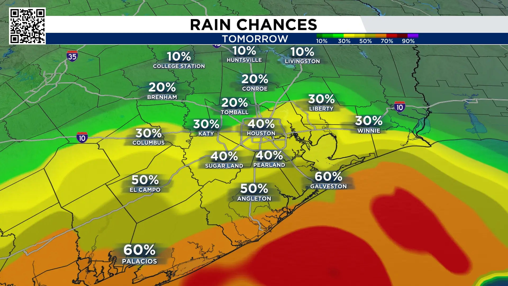
Thursday’s forecast:
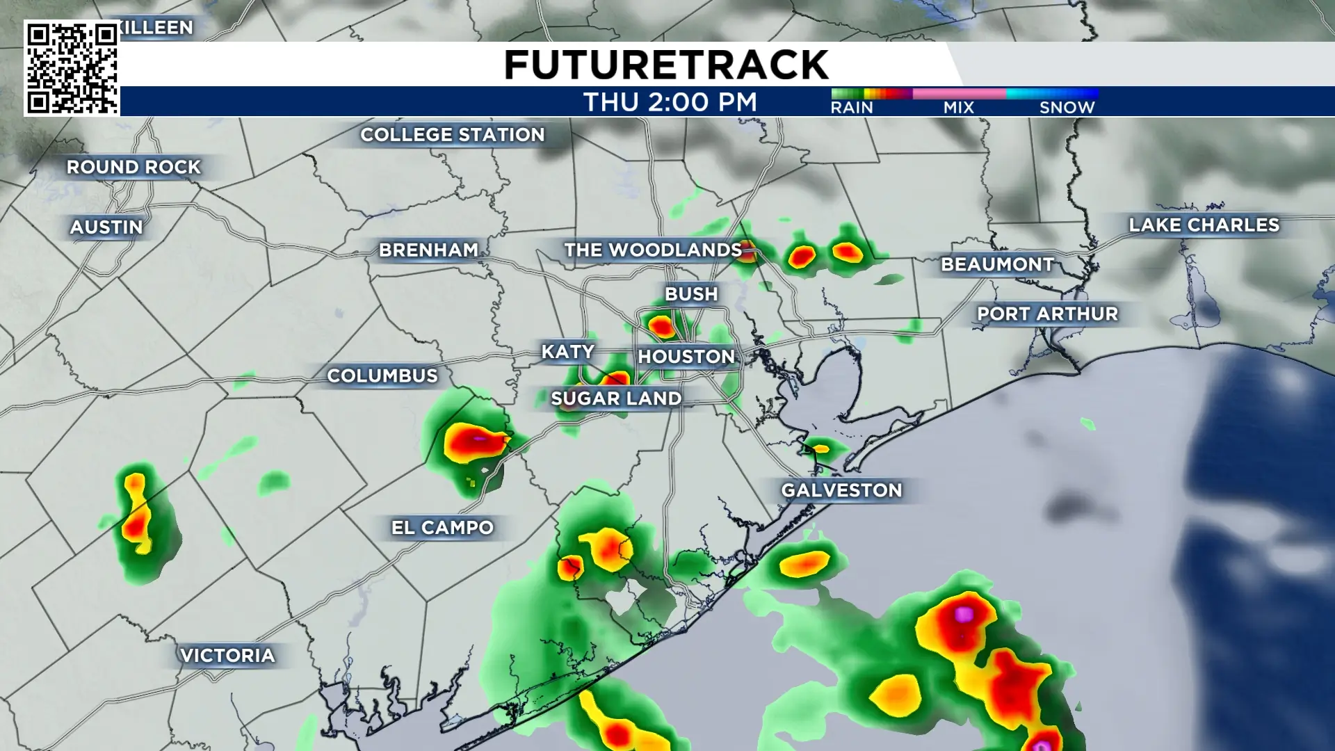
The tropical wave we’ve been watching all week moves into southeast Texas Thursday. This is tropical moisture capable of bringing widespread heavy rain. But we have one big issue preventing how much of us get rain. We have a strong inversion, lid or cap above our atmosphere. That will limit cloud growth, which will make it difficult for storms to intensify and spread. I’m going with a 40% chance of storms in Houston Thursday. It’s a day with high potential but will probably not live up to it.
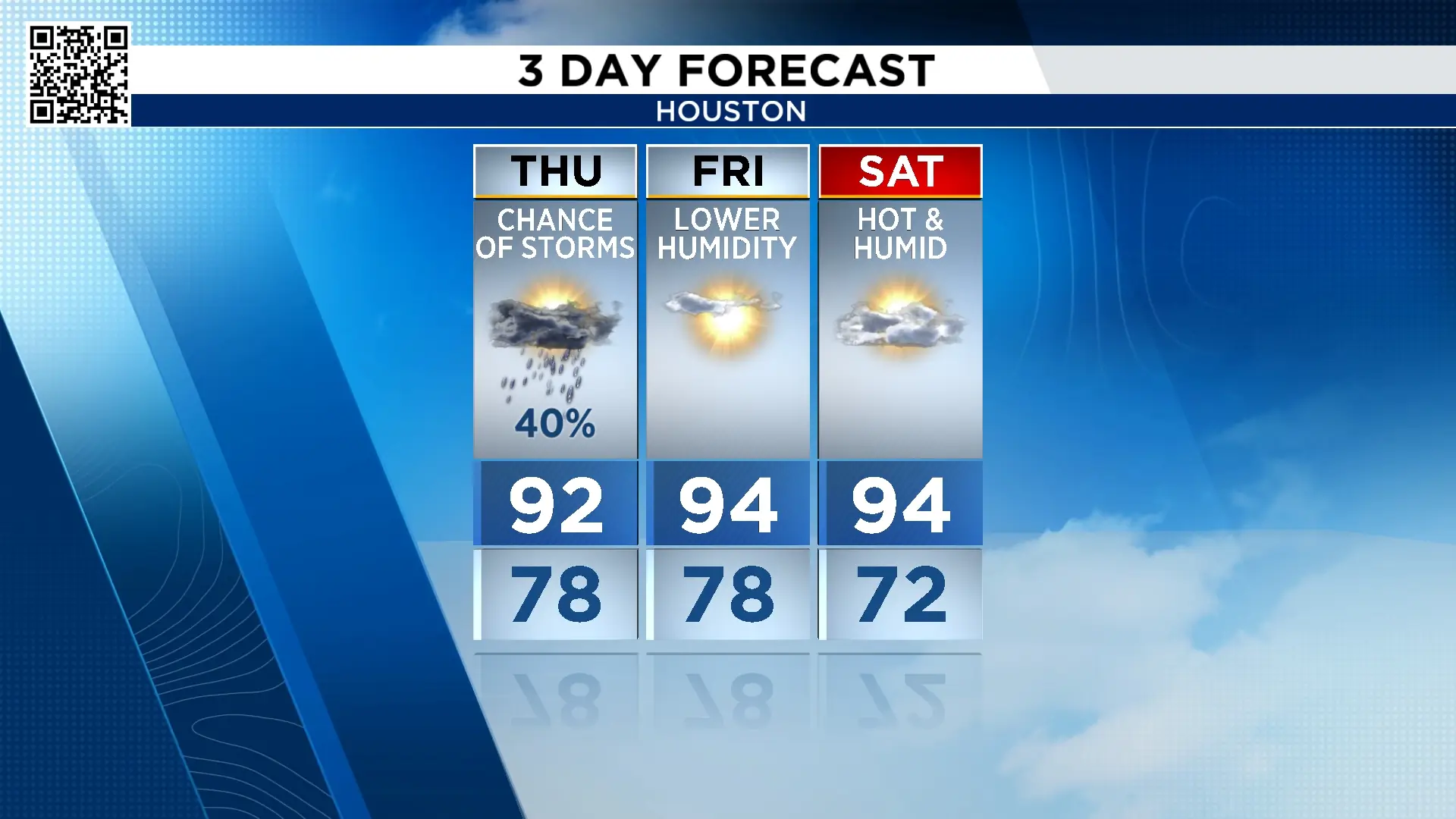
You are going to love the way it feels Friday:
After the rain moves out, dry air from the northeast moves in. This will lower the humidity Friday afternoon and night. It will still be hot with high temperatures climbing to the mid-90s, but with a low humidity it will feel like a 100° at the most. You’ll really enjoy Friday night and Saturday morning.
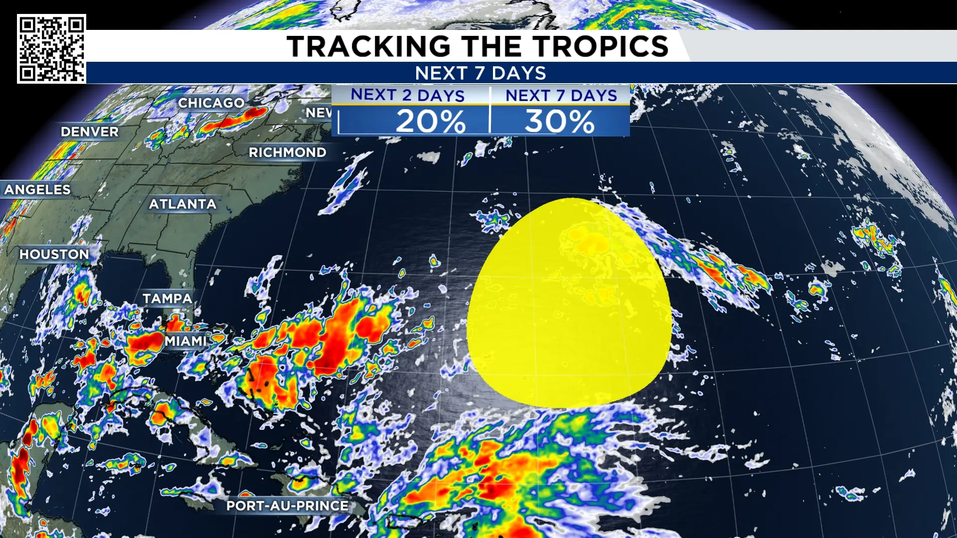
Tracking the tropics:
Storm development chances in the Atlantic have for the most part remained constant since Tuesday. The area in yellow now has a 30% chance of becoming a named storm.
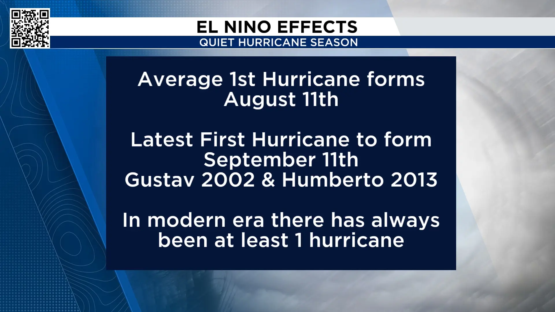
So far this hurricane season, we have not had a hurricane form in the Atlantic basin. The latest first hurricane to form was Gustav and Humberto, which formed on September 11th. This means our 2026 hurricane season set a record for the latest hurricane to form.
Extended forecast:
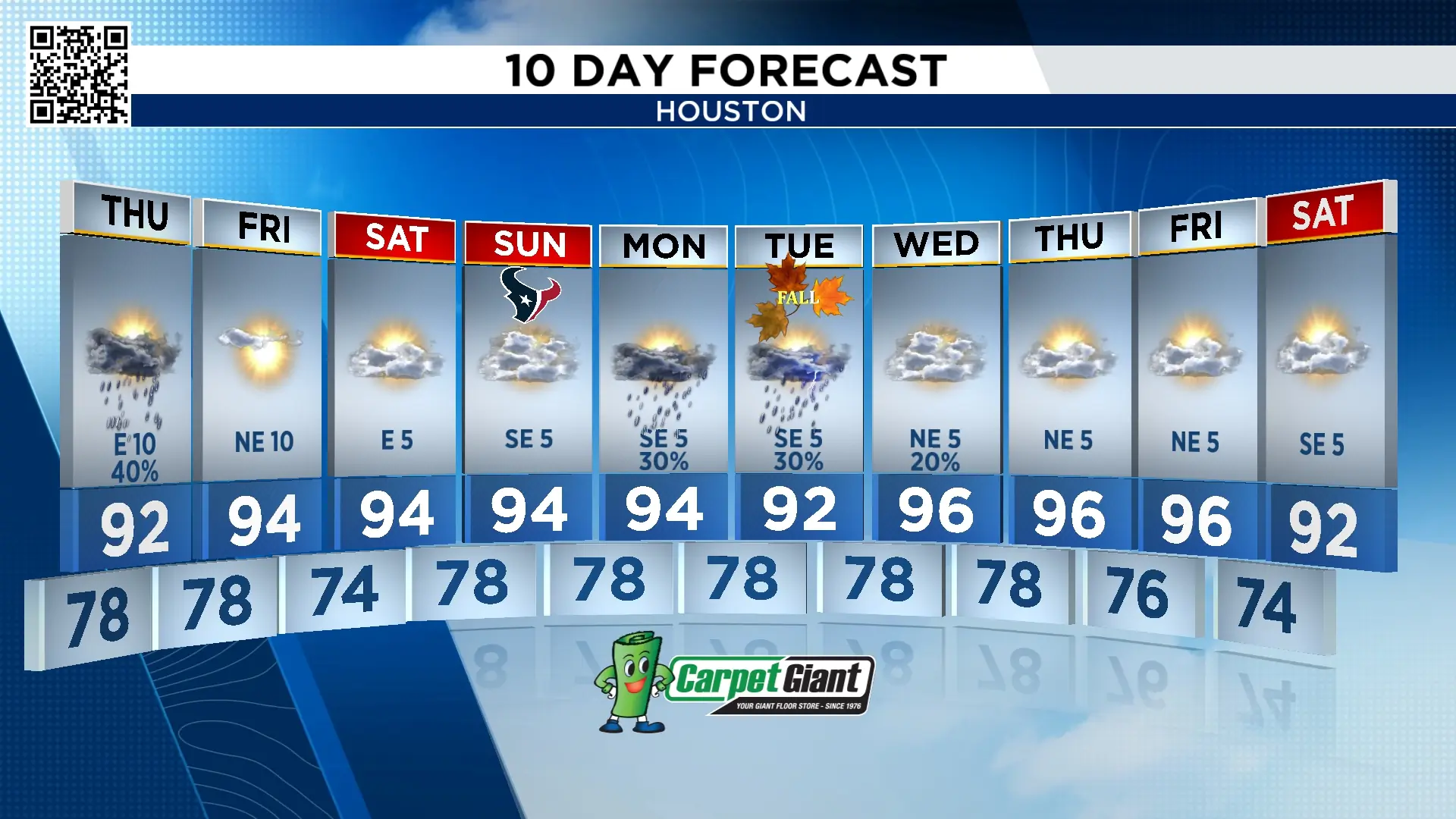
There is no big cool down in the forecast. There are periods of dry air but highs are in the 90s for the next 10-days. More storms are possible Monday and for the official start of Fall next Tuesday. On Monday September 21st the average high temperature falls to 89°! We however, are above that number next week.

More Stories Like This In Our Email Newsletter
