
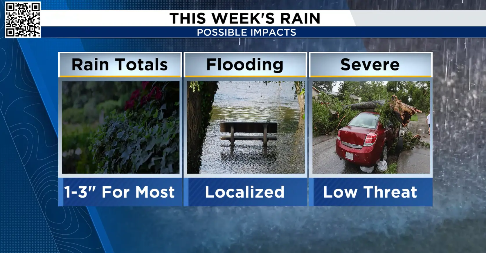
HOUSTON – The Houston area is in for several rounds of rain and thunderstorms through the weekend, with storms becoming more numerous at times as a front approaches.
Most areas could pick up 1 to 3 inches of rain, with locally higher amounts possible where storms repeatedly move over the same areas. Central Texas could see 3 to 6 inches or more.
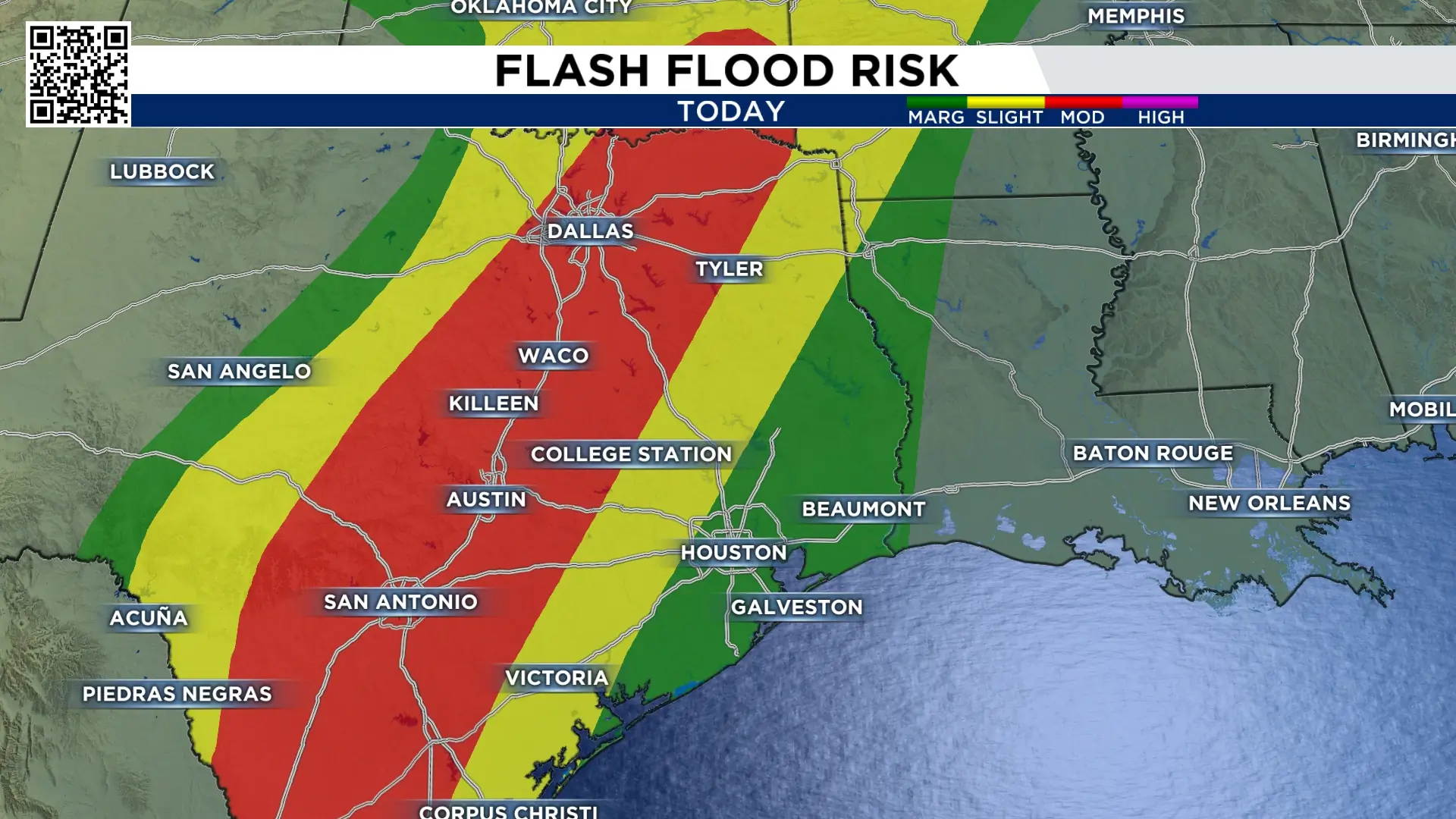
The main concern locally will be flooding in the heaviest downpours, particularly in areas that receive multiple rounds of rain.
Thursday
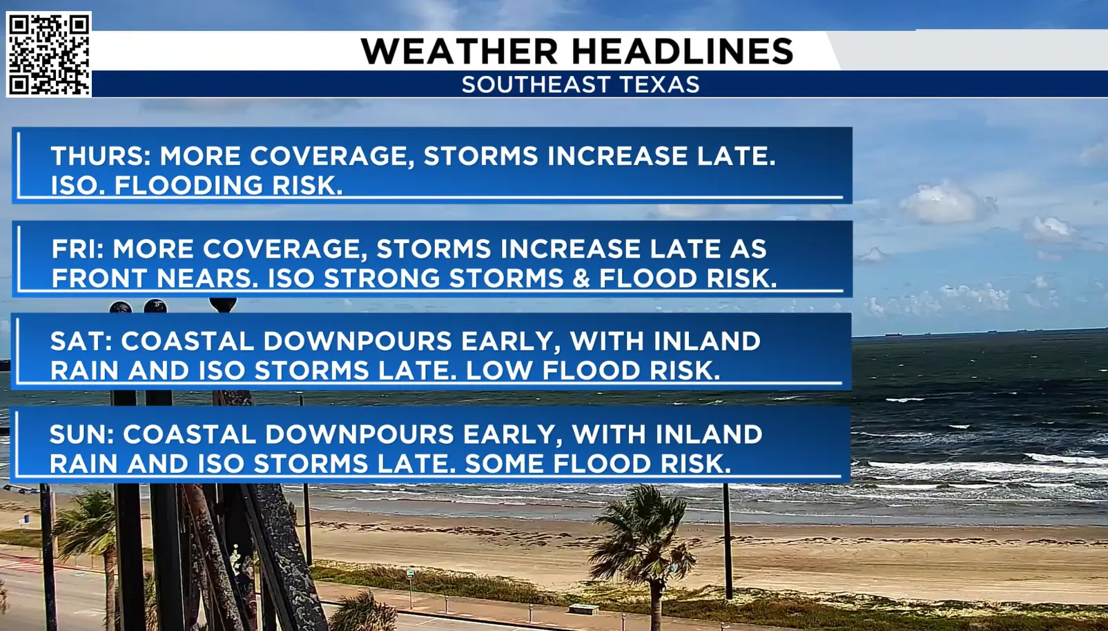
Rain and storm coverage will continue throughout the day, with thunderstorms becoming more numerous late.
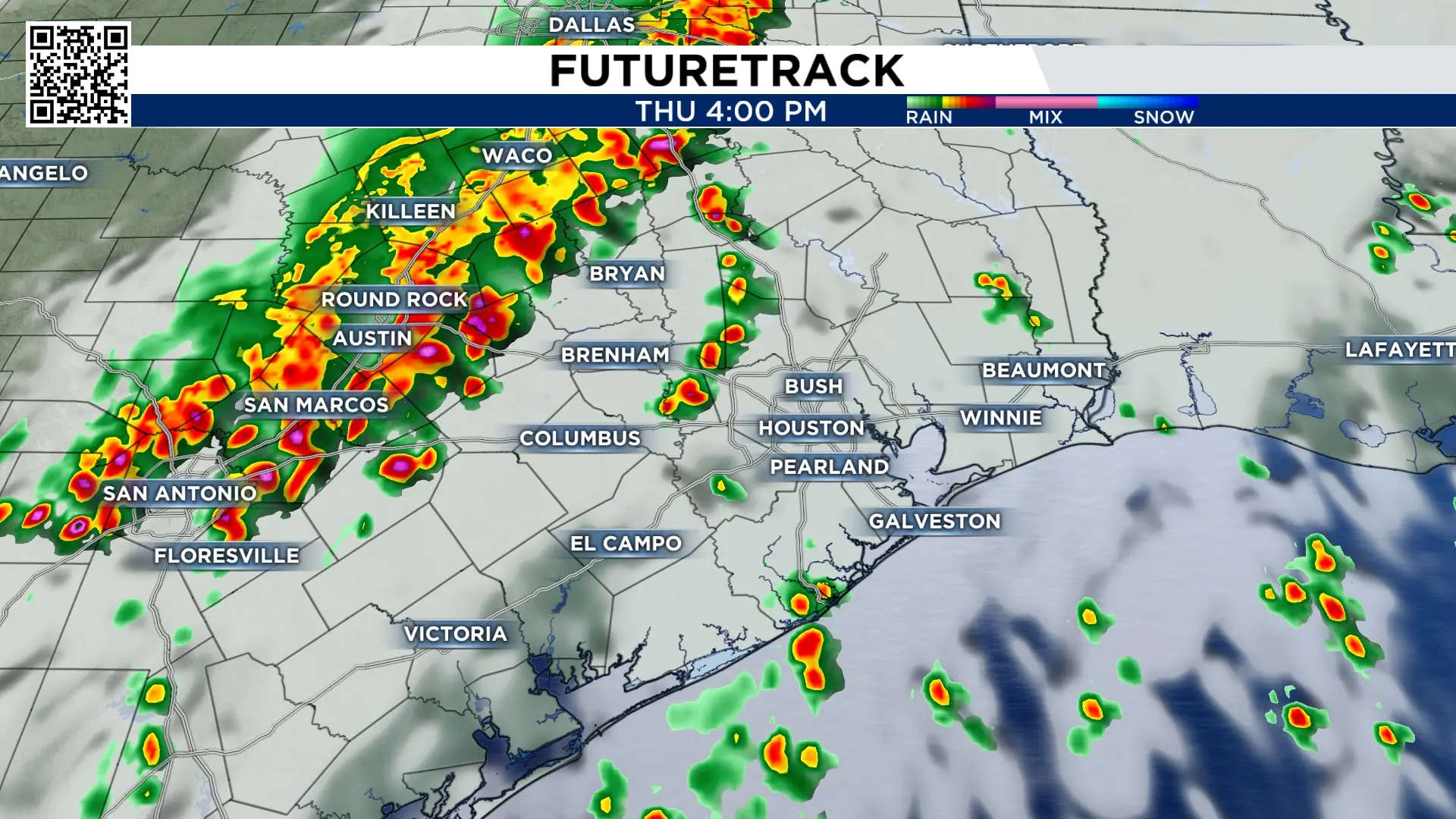
The best chance for storms will be across west and southwest areas. A very isolated flooding threat is possible, mainly where heavier storms linger or repeatedly move over the same location.
Friday
Another round of rain and thunderstorms is expected, with storm coverage increasing late as a frontal boundary approaches.
A few storms could be strong, especially closer to the front. The strongest storms could produce gusty winds and frequent lightning.
There is also an isolated flooding risk, particularly in areas that receive repeated or especially heavy rainfall.
Hail is not expected to be a major concern, although a few of the strongest storms near the front could produce small hail.
Saturday
The day could start with downpours along the coast, while rain and thunderstorms expand farther inland later.
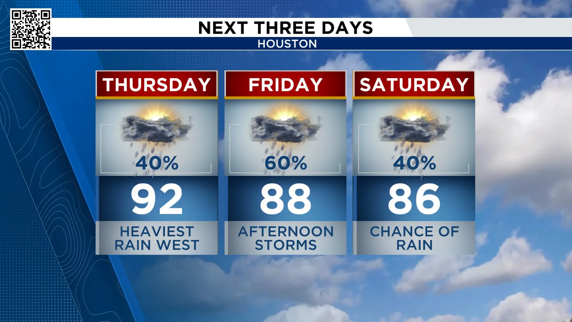
The flooding threat remains isolated, but areas that have already received rain could be more vulnerable if additional heavy rainfall moves over the same spots.
Sunday
Another round of coastal downpours is possible to start the day, with rain and thunderstorms spreading farther inland later.
Some storms could be strong, and flooding could become a concern in locations that see the heaviest rainfall.
Rainfall totals
Most of the area could see 1 to 3 inches of rain through the weekend, with locally higher amounts possible.
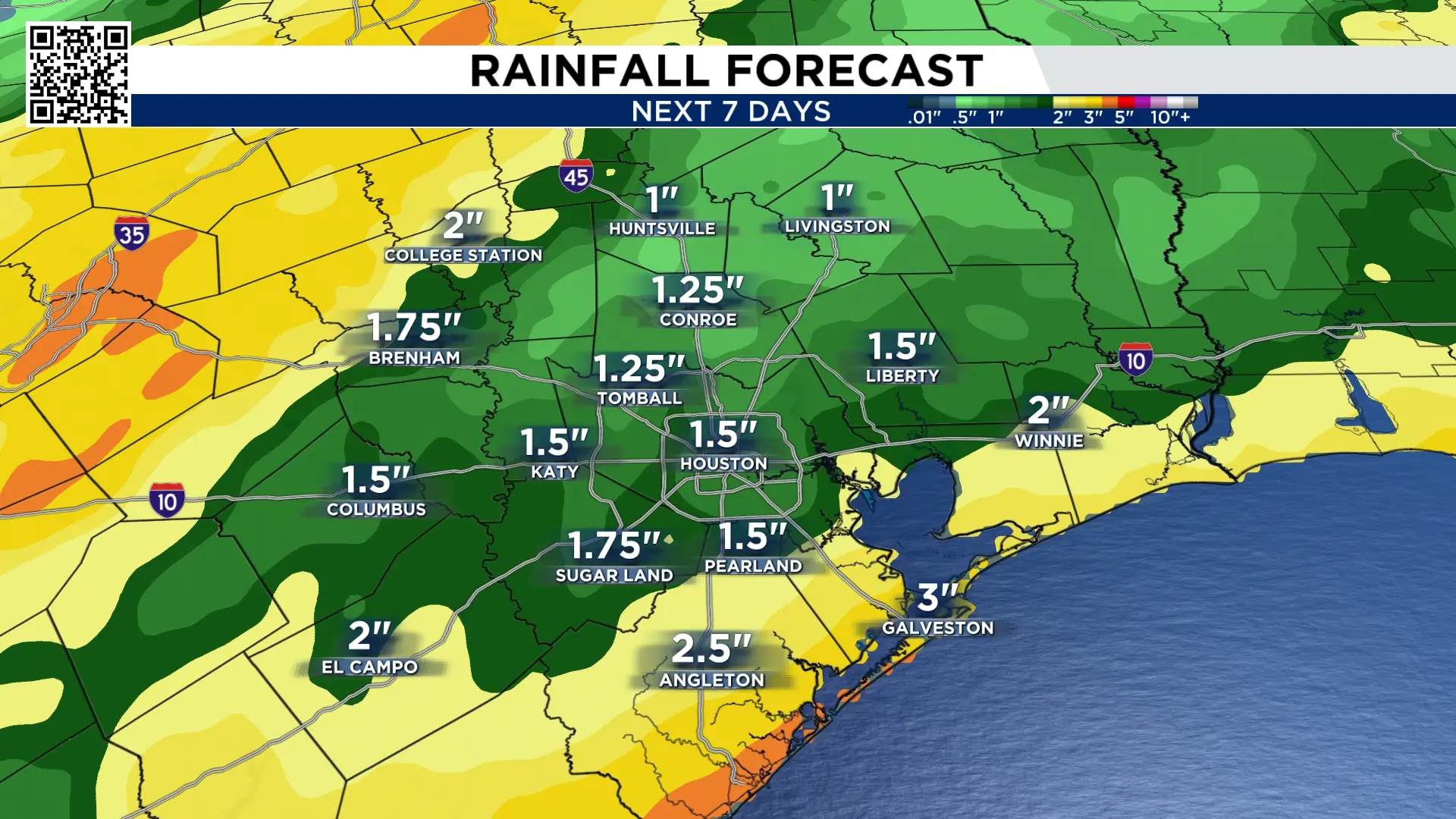
If thunderstorms stall or repeatedly move over the same areas, rainfall totals could climb significantly higher.
Central Texas could see 3 to 6 inches or more.
Weather threats
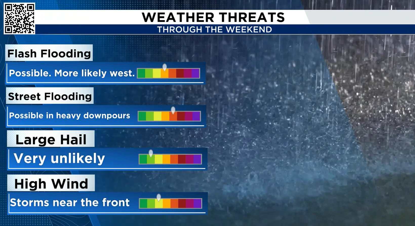
- Flash flooding: Low to medium. Most likely in the heaviest thunderstorms that stall over the same area.
- Street flooding: Medium. The strongest storms and areas that experience repeated rounds of rain could see temporary street flooding.
- Hail: Very low. Small hail could occur in a few of the strongest storms near the front Friday.
- High winds: Low to medium. The strongest wind gusts would be possible in the heaviest storms near the approaching front Friday.
- Lightning: Frequent lightning will be possible in the stronger thunderstorms.
